
Map-i-fying data using MapBox
What is MapBox?
Have you ever felt like Google maps seems somewhat dull as a mapping platform? Worry not — Mapbox is coming to the rescue! I came across Mapbox last week during a hackathon and thought I'd give it a shot. I loved its map creating platform (i.e. Mapbox Studio)! In this post we will discuss how to create a simple data based map on MapBox studio.
What are you waiting for?
-
Grab the accident dataset here . Remember that the dataset should always have Latitude and Longitude columns in order to be read by mapbox.
-
Get registered on Mapbox
-
Open the Mapbox studio by clicking the studio button at top right.
-
Click on 'Tileset' (on left hand menu), click on 'New Tileset', and upload the file(
lat_lon.csv). -
Wait for the new tileset to be created. Next, click on the 'options' button for the created tileset and select add to style.
-
Choose a style that suits you and be sure to rename the style being saved.
-
You will then be taken to a the map editor. Click on 'Create layer' to confirm the creation of a layer from your data. You can add, remove, hide, and show different map features by using the left hand side layers list.
-
Select your data layer, click on style options for the layer, and edit to your chosing.(You can change colors, sizes, blur, and opacity of data points manually or you can add functions to do so).
-
Once you are finished, click on 'publish' and voila! It's finished!
You can then access the published style from here. Click on the 'options' button for your style and select '</> Share, Develop and use'. From this page, you can get your shared URL for public access and your style url-access token pair for API integration.
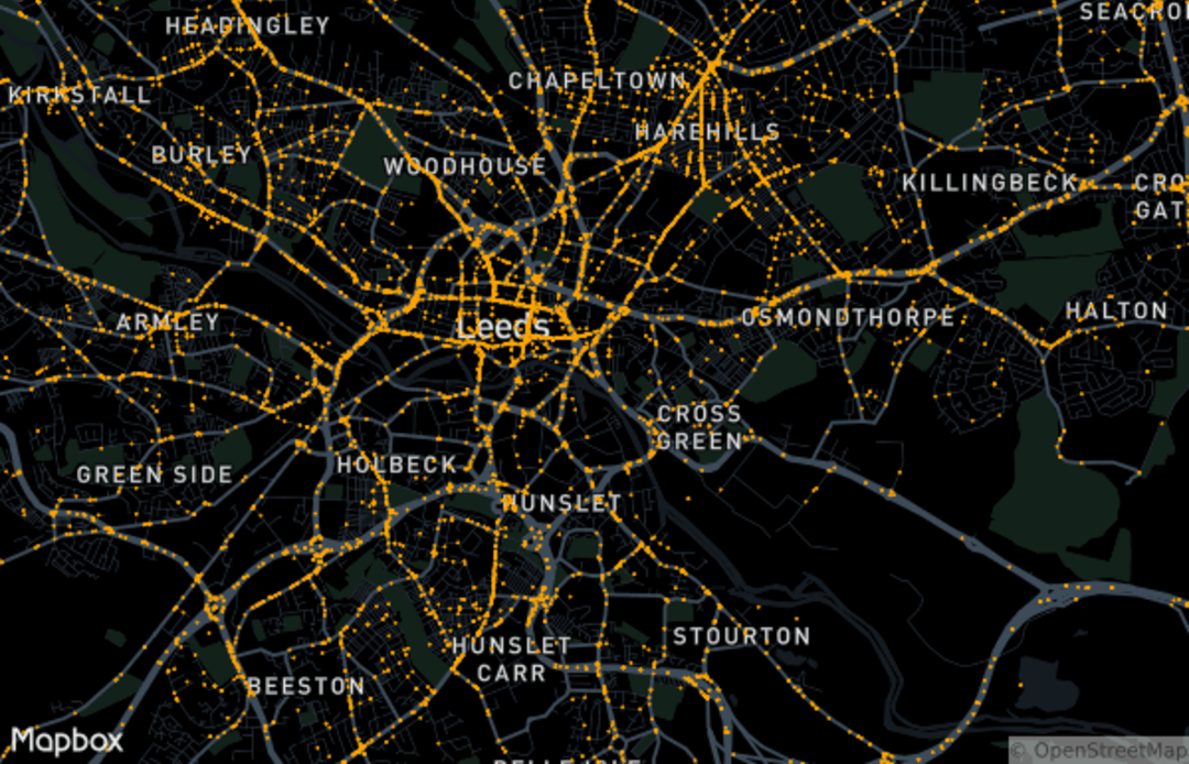
Check out my map here and be sure to zoom in around Leeds (UK)
!
Useful links
Here are a few links you might find useful!
Additionally, if you're interested in learning more about other mapping tools, check out Google Maps API or Leaflet: What's Best for your Project? by Victor Gerard Temprano!
I am always available to answer any questions you may have at Abhay447!